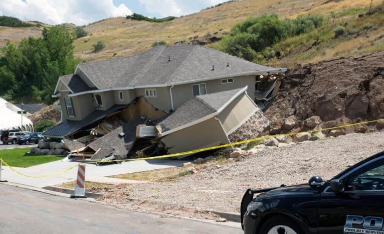
Landslide Risk in Wyoming: Sheridan County Tops List of Vulnerable Areas

A recent analysis by Truck Parking Club, using Geological Survey data, has identified Wyoming counties most susceptible to landslides, with Sheridan County emerging as the most at-risk, the Cheyenne Post reports.
Landslides are a growing concern nationwide, often triggered by heavy rainfall, snowmelt, and human activities, and exacerbated by the impacts of climate change.
In Wyoming, over half of the land in 14 counties is at risk of landslides. Mountainous regions, steep slopes, and areas with fractured or unstable earth are especially vulnerable. Sheridan County leads the rankings, with 79.1% of its land area, or nearly 2,000 square miles, identified as susceptible to landslides. Hot Springs County follows closely, with 78.9% of its land area at risk, and Park County ranks third, with 74.9%.
Here are the top five Wyoming counties most vulnerable to landslides:
- Sheridan County: 79.1% of land area at risk (1,999 square miles)
- Hot Springs County: 78.9% (1,584 square miles)
- Park County: 74.9% (5,202 square miles)
- Teton County: 73.9% (2,949 square miles)
- Johnson County: 71.2% (2,967 square miles)
Landslides can be deadly and costly. In 2024 alone, landslides worldwide resulted in over 2,300 fatalities in the first half of the year. In the US, landslides claim an average of 25 to 50 lives annually. The destruction extends to roads, infrastructure, homes, and businesses. For instance, Hurricane Helene in 2024 triggered nearly 2,000 landslides, killing 20 people in North Carolina and causing billions in damages.
Wyoming’s susceptibility is influenced by its mountainous terrain and the increasing frequency of extreme weather events like heavy rains, a consequence of climate change. Additionally, human activities such as mining, deforestation, and urbanization further destabilize the land.
Experts emphasize the importance of preparation, including landslide drills, improved drainage systems, slope stabilization, and disaster-resilient building codes. Hazard maps from the Geological Survey help state and local governments identify vulnerabilities and develop mitigation strategies.


